GET THE DATA YOU ARE LOOKING FOR IN JUST A FEW CLICKS WITH
Linkdata
Try LinkData to save valuable time and get accurate and detailed information for every renewable project of your pipeline. Buy the bundle you prefer and enjoy countless benefits forever.

TIRED OF WASTING TIME AND MONEY SEARCHING FOR LAND CADASTRAL DATA?
Have you ever found yourself spending hours and hours searching for cadastral and real estate data, only to discover that the information you found was outdated and inaccurate? Would you like a solution that provides you with accurate data even for large areas?
With LinkData, you have immediate access to complete, georeferenced, ready-to-use cadastral data. With our service, you get accurate, up-to-date and complete records, saving time and money in just a few clicks!
What linkdata is
A SERVICE THAT PROVIDES YOU WITH AN EXCLUSIVE SOURCE OF DATA, CONSTANTLY UPDATED AND AVAILABLE FOREVER.
LinkData is not only a unique service, but a concrete answer to the daily challenges faced by professionals and companies in the real estate and renewable field.
It stems from the need to simplify the usually complex and laborious management of cadastral data by offering a bottom-up approach that starts from your needs and goes to practical and cost-effective solutions.
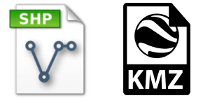
Thanks to our intuitive and user-friendly platform, you can instantly access a wide range of information, starting with basic details such as Region, Province, Municipality, Folio and Parcel, to obtain the georeferenced map perimeter, complete with identifying attributes in convenient Shapefile and KMZ formats. All with considerable savings in time and cost.
How it works
GET DATA IN A SHORT TIME WITH A CONVENIENT, FAST SERVICE THAT CANNOT BE FOUND ELSEWHERE AT A VERY LOW PRICE.

01
BUY YOUR BUNDLE OR CHOOSE THE CUSTOM OPTION
Choose the bundle that best suits your needs. With a single purchase, you get instant and unlimited access to a reliable source of data. Can't find the bundle that best suits your needs? Select the functionality you need and get a tailor-made quote.
ENTER DATA
Once you have purchased the bundle, you are done! Log in to the LinkData platform and start exploring the data. For example, you can start by entering the cadastral details such as Region, Province, Municipality, Folio and Parcel of your interest.
02
03
GET THE INFORMATION QUICKLY
Get a complete record with all the data you need including the georeferenced map perimeter, complete with identifying attributes. The data are provided in Shapefile and KMZ formats and make use of open-source software such as QGIS and Google Earth. This will allow you to easily perform tasks such as measuring the plot area or checking for interference with environmental and landscape constraints, making the design process more efficient and accurate.
Why use linkdata
CHOOSE LINKDATA AND RECEIVE A TANGIBLE ADVANTAGE IN MANAGING THE DATA YOU NEED!
COMPETITIVE
PRICE
With LinkData, you get a high-quality service at a lower cost than with traditional procedures. Save on operational costs by acquiring reliable and complete data.
RAPIDITY IN DATA DELIVERY
With LinkData, you get a high-quality service at a lower cost than with traditional procedures. Save on operational costs by acquiring reliable and complete data.
GUARANTEED
PRECISION
Rely on LinkData for detailed cadastral data. Thanks to our advanced technology, you can be sure of receiving reliable and constantly updated information.
IT IS UNIQUE
IN ITS KIND
There is no other service like LinkData. LinkData is a unique and exclusive tool that offers you a complete solution based on your requirements.
TO WHOM linkdata IS ADDRESSED
WE CONCEIVED LINKDATA AS AN EXCLUSIVE SERVICE FOR DIFFERENT CATEGORIES OF PROFESSIONALS AND MORE

LinkData is designed for professionals and companies active in the real estate sector, including engineers, architects, agronomists and developers in the renewables sector. Are you tired of manually dealing with large amounts of cadastral and real estate data?
Do you need a solution that optimises time and reduces operating costs?
LinkData is the answer to your needs. Thanks to our intuitive platform and advanced technology, you can quickly and efficiently manage cadastral planimetric data in vector format, guaranteeing the accuracy and georeferencing required for your projects.
try Linkdata
CHOOSE ONE OF OUR BUNDLES!
QUESTIONS? WE ANSWER HERE
LINKDATA IS A UNIQUE SERVICE THAT CANNOT BE FOUND ELSEWHERE, WHICH IS WHY WE HAVE CURATED A SELECTION OF THE MOST FREQUENTLY ASKED QUESTIONS. IN JUST A FEW CLICKS, YOU WILL FIND THE ANSWERS YOU ARE LOOKING FOR QUICKLY AND INTUITIVELY.

All right reserved 2024
Legal and operational headquarters: Castel San Giorgio (SA) - Via SS 266, Exit Autostrada A30 SNC, CAP 84083 | VAT number 06148460659